Tondela
 |
 |
Local writer and intellectual Amadeu Ferraz de Carvalho (1876–1951) wrote of the municipality of Tondela in the following terms: "'The municipality of Tondela extends over the plateau, covers part of the eastern slope of Caramulo and surpassing the saw still slopes through the highlands of São João do Monte, over the gentle flanks of the upper Águeda basin. In this way, the natural sections of your area are: part of the plateau, cut by the Dão and its effluents the Paiva and Dinha [rivers]; the depressed lands between the plateau and the Serra do Caramulo, drained by the Criz [River] and its effluents; a part of the eastern flanks of the Caramulanian mountains and elevated east around the Águeda basin; and I add, an extreme basin, with Quaternary deposits, that indicate small extinct lakes, along the Serra do Caramulo; and the Vale de Besteiros.'" In this context, the region of Tondela appears as one of the principal locations of archaeological remnants and concentrations of prehistoric populations.
The traditional origin of the name Tondela is made concrete at Chafariz das Sereias (literally, "Spring of the Mermaids"), a sculpted spring of stone depicting a woman holding a trumpet. Legend suggests this female figure represents a woman who monitored the movements of Moorish forces across the mountains from her lookout. When she discovered an impending attack she would sound the horn, and at the sound of this instrument the settlers would arise to meet the enemy. The phrase "ao'tom'dela"—literally, "at her sound" or "at the sound of it"—was transformed into the name Tondela.
Documents from the 9th, 10th, and 12th century designate this region Terra de Balistariis. This designation arises from the word ballista, a ranged weapon used by besteiros ("crossbowmen") during the Middle Ages.
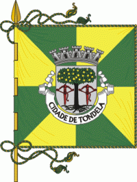
The current municipality was until 1836 the seat of the historical municipality of Besteiros, whose name continues to be seen in some historical documents, references, and coat of arms of Tondela. To this former administrative division were annexed through successive administrative reforms the older entities of Serra do Caramulo, São João do Monte, and Guardão. The lowlands of Mouraz, Sabugosa, Canas de Santa Maria, São Miguel de Outeiro, and a few parishes that were part of Viseu or the smaller municipalities of Barreiro and Treixedo were also extended into Tondela.
Map - Tondela
Map


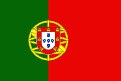
Country - Portugal
 |
 |
| Flag of Portugal | |
One of the oldest countries in Europe, its territory has been continuously settled, invaded and fought over since prehistoric times. The territory was first inhabited by pre-Roman and Celtic peoples who had contact with Phoenicians, ancient Greeks and Carthaginians. It was later ruled by the Romans, followed by the invasions of Germanic peoples and the Islamic invasion by the Moors, whose rule was eventually expelled during the Reconquista. Founded first as a county of the Kingdom of León in 868, gained its independence as the Kingdom of Portugal with the Treaty of Zamora in 1143.
Currency / Language
| ISO | Currency | Symbol | Significant figures |
|---|---|---|---|
| EUR | Euro | € | 2 |
| ISO | Language |
|---|---|
| PT | Portuguese language |